
Fact Sheet
Investigative Activities
October 2002
Geophysical Survey Methods Used at Site Investigations at Radford Army Ammunition Plant (RFAAP)
Introduction
Geophysical surveying is utilized at waste sites to locate various subsurface features that may be present at the site while being minimally invasive of environmental media. At Radford Army Ammunition Plant (RFAAP) the features most commonly of interest are areas of possible buried waste/debris, the top of bedrock, and rock type. Geophysics can also provide information regarding other subsurface geological features e.g., bedrock fractures and groundwater properties. Collecting geophysical information prior to formulating investigation work plans is efficient and cost effective, because sampling locations and depths can be optimized to provide data in areas of interest with a minimum amount of sampling. Geophysical surveying at RFAAP uses an integrated borehole and surface approach. The following paragraphs describe and illustrate the equipment used.
Borehole Methods
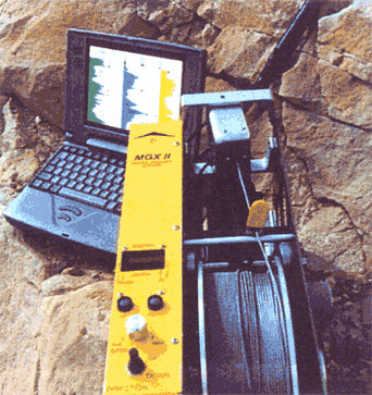
Borehole methods use various probes to measure different properties of the soil and rock penetrated by a well. The fluid probe measures thermal and electrical properties of groundwater in a well. The natural gamma probe estimates soil and rock clay content by measuring naturally occurring radiation in penetrated soils and rocks. The induction probe emits a magnetic field to measure soil and rock electrical properties. When run with the natural gamma probe, the combined data helps define rock type, depth of potential weathered or water-producing zones, and calibrates surface geophysical methods. These probes were deployed using a motorized winch with the data recorded and monitored by a laptop computer (Figure 1).
 |
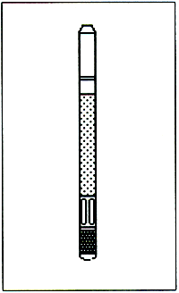 |
Figure 1. Left hand photograph is a logging winch, cable, and laptop. The right hand drawing is a fluid probe 21-in long by 1.5-in diameter (courtesy Layne-Christiansen Colog, Golden CO).
Vertical and Horizontal Seismic Profiling
Vertical seismic profiling uses a device known as a geophone that is lowered into a monitoring well in order to measure the rate at which a mechanically-induced vibration is transmitted through the soil and rock penetrated by monitor wells.
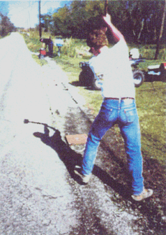
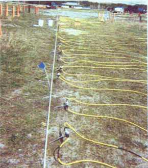
Horizontal seismic profiling is similar to vertical profiling except that a linear array of geophones are placed on the ground surface (see Figure 2), and an low-energy impact source is used to generate the requisite vibration. Low-energy impact sources such as sledgehammers and weight drops are typically used for environmental investigations. Figure 3 shows examples of a sledgehammer (left picture) and the accelerated weight drop (AWD) energy sources employed at RFAAP. Both sources use a steel plate place on the ground surface as the impact point in order to impart vibration into the ground. The plate also serves to minimize damage to the ground surface. Ground vibrations generated by the AWD are barely noticeable by human senses at distances of 10-20 ft from the source.
 |
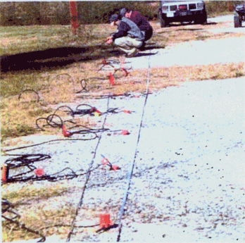 |
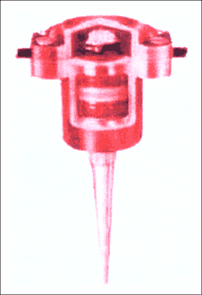
Figure 2. Geophone (left) and Seismic Cable Layout (Anniston Army Depot, Alabama).
 |
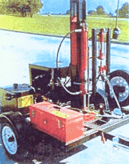 |
Figure 3. Seismic Energy Sources: Sledge Hammer (left) and drop weight (right) (Louisiana)
Resistivity Profiling
Electrical resistivity profiling is used to measure variations in the electrical properties of the subsurface, which are correlated to the underlying geology and hydrogeology. Like the seismic survey, a linear array of receivers (in this case electrodes) is placed on the ground surface. During the survey, two of the electrodes are used to impart a low-amperage electric current (less than 2% of a household current) into the ground, and the other electrodes are used to measure voltage changes along the profile.
Figure 4 shows an array of electrodes with connecting cable (yellow) in the left picture, and the controller and recording gear in the right picture. The electrodes are approximately 12 inches long and 3/8 inch in diameter, and are inserted from 3 to 8 inches into the ground. Like the seismic survey, little to no damage is done to the ground surface during the collection of the resistivity data.
 |
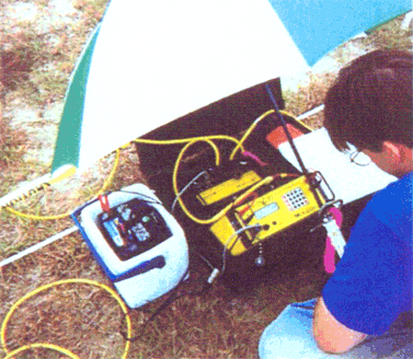 |
Figure 4. Resistivity cable and electrode layout plus controller and recording gear (Hunter Army Air Field, Georgia).
EM Methods
Electromagnetic-induction instruments (EM-31 and EM-34) are used to measure the electrical conductivity of the soil near the ground surface. EM methods are often used to locate possible buried metallic objects.
The EM instruments are carried over the shoulder with data collected continuously as the technician...